Wasatch Traverse

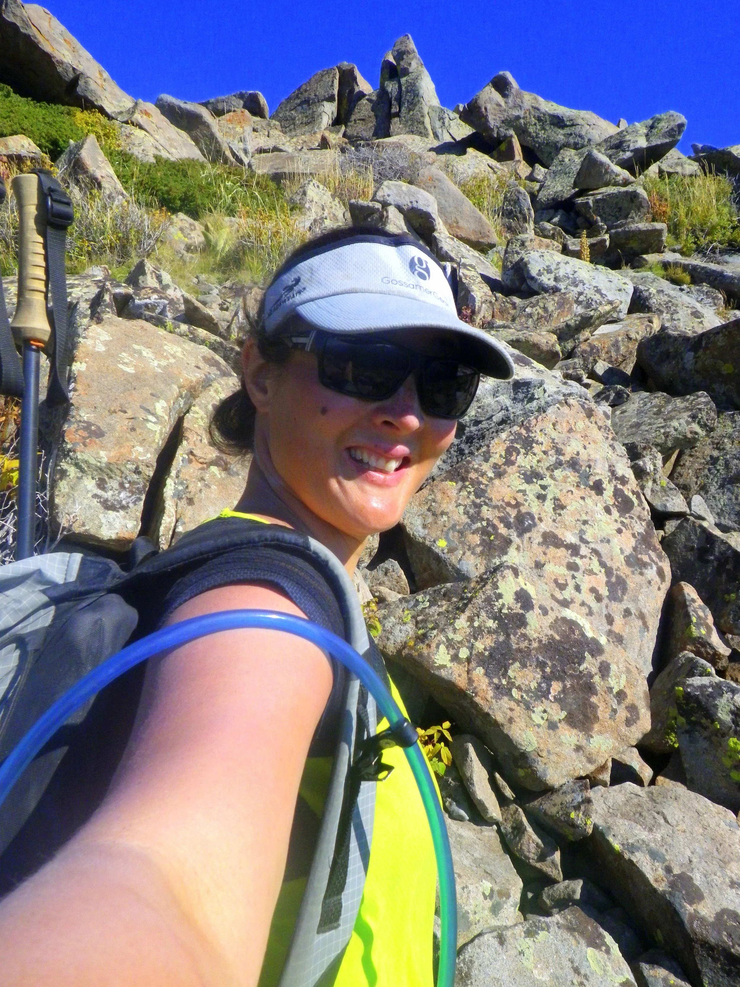
The Wasatch Range Traverse in Utah has been on my radar for 3 years, ever since Altra Zero Drop shoes founder Jeremy Howlett first mentioned it to me as “something you thru-hiker types should try.” The range is in his backyard and easily accessible to the Salt Lake Metro area, but to his knowledge had never been fully explored as a thru-hike.

It’s intimidating rolling up to an unknown place to do a trip that, to your knowledge, no one has never done. Luckily, the whole Altra family was unbelievably supportive and helpful on my trip. Altra employees and enthusiasts living all across the 300 mile range gave me beta—from logistics like how to get from the Salt Lake City Airport to maps put together by Jeremy. I’m enormously grateful to those who helped me make this trip possible.

What enthralled and surprised me about this steep and rugged range were the contrasts: the striking difference between the remoteness and solitude of the route, yet being able to see towns below and often have cell reception. The mindgame of being able to see green farms thousands of feet below me in the valley, but not see water on my route for 30 miles. The landscape itself was diverse from the lush, almost temperate rainforest-like ecosystems near certain creeks to the scrubby dry lands of the rest of the route.

As with all the routes I walk, what inspires me is the idea that with more planning and research, this can be an amazing trip that someone would want to replicate. Here are some stats to get your mind wheels turning.
Trip statistics:
Dates: September 4th to September 14th
Mileage: Estimated somewhere between 250 and 300 (as mapped in the comfort of home, came in as 283 before on-trail changes we made)
Start: the northernmost part of the Wasatch National Forest in the Wellsville Wilderness
Finish: Southwest side of Mt. Nebo Wilderness

Elevation Gain: The Wasatch has a whopping 85,000 feet of elevation gain over the 300 mile hike, putting it at 120% of the elevation gain per mile of the Appalachian Trail, the trail with the most climbing per mile and total climbing of any the Triple Crown Trails (515,000 feet of gain over 2,185 miles vs. the Pacific Crest Trail’s 489,000 feet of gain over 2,650 miles). The start of the trip is the Wellsville Range, called the “steepest mountain range in the world.”

Navigation/Maps: The route utilizes trails, off-trail, jeep roads and paved roads. Almost none of the trails are signed (and since the route was made up, of course even when there were signs, there was no sign that said “Wasatch Traverse that-a-way”). The off-trail sections vary between some of the most horrendous bushwhacking I’ve ever done to minor scrambling to some straightforward sections. Detailed maps and a compass were essential. For overview maps, I used the National Geographic Maps Logan/Bear River Range #713, Ogden/Monte Cristo Range #700, Wasatch Front North #709, and Wasatch Front South #701. For higher detail, I used 1:24K scale USGS topo maps (7.5-minute), that I printed out and carried with me.

Resupply points: I-15 and the Salt Lake City Metro area are right up against the range, meaning that almost every low pass is a major road that leads to a town. You could potentially resupply everyday if you wanted to do that much hitch hiking. From 91, you can hitch into Wellsville or the much closer Brigham City. There are snacks and maybe hotdogs available at the marina at Pineview Trailhead, and fancier snacks and meals can be purchased at the Snowbird Ski area (at least on the weekends). The trail takes you through the town of South Ogden, where you can detour slightly to a Walmart and walk right past a Best Western. From I-80, you can go into Salt Lake City or Park City if a friend is willing to pick you up, although hitch hiking here is probably very difficult. There is a small store at Brighton or a city bus in Big Cottonwood Canyon that can take you to a 7-11. Then, the trail takes you past/near the Sundance Ski Resort or you can hitch into Provo from 189.

Water: At this time of year, up to 30 miles between sources. I’d say 1 in 10 of the sources I anticipated from looking at the map actually had water—everything else was long dried up.

Wildlife: Much to my surprise, the Wasatch Traverse turned out to be one of my best wildlife viewing hikes ever! I had two first sightings—a ferret and a badger! I saw three moose, and one was a bull moose up close. Elk were bugling. Deer were being annoying. And most importantly, I saw no venomous snakes!
Highlights:

Seeing fall colors in the Mt. Timpenogos and Mt. Nebo Wildernesses, which (and I know this is sacrilege) actually was more beautiful and certainly offered more solitude than any fall color peeping I know of in Colorado.The rugged Type 2 fun of the Wellsville Range
Walking some of the route of the famous Wasatch 100 ultramarathon course
Climbing peaks along the route
Seeing Snowbasin (the 2002 Winter Olympic location)

Walking past historic sights like Big Mountain Pass (where the Donner Party cut through the trees and ultimately wasted a lot of time leading to their winter in Truckee and the next year was used by the Mormon Emigrants reached Salt Lake)
Seeing historic artifacts and fossils
The kindness of all the people I met.